Clontarf Hill
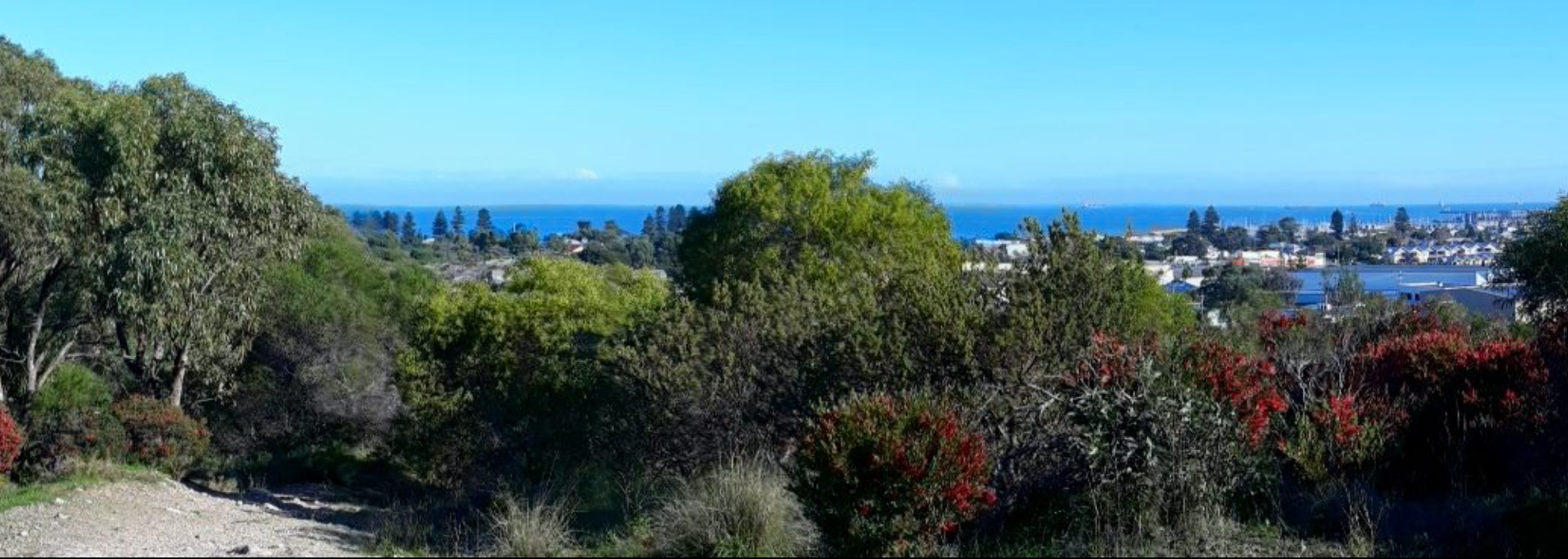
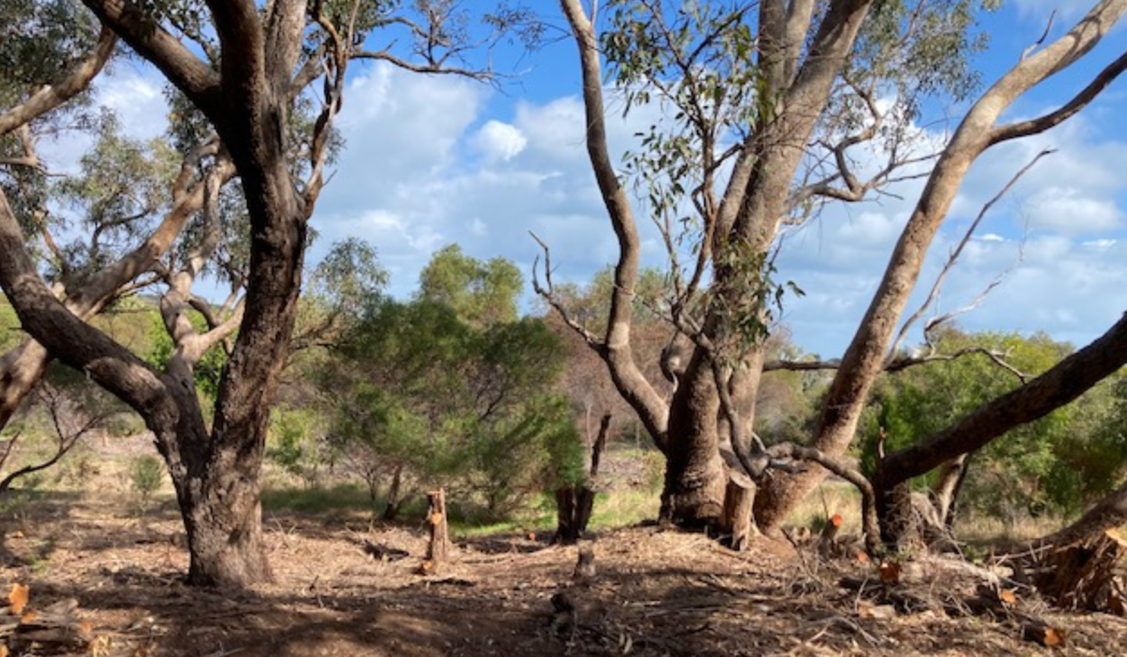
Clontarf Hill is unique in that it is the only remaining natural limestone hill at the southern end of the Fremantle area with views west across the Indian Ocean and offshore islands, as well as coastal views north and south including Fremantle and its Port. Clontarf Hill contains one of the only remaining stands of old-growth Tuart trees in the Fremantle area and forms part of essential habitat linkages for native flora, fauna and birds. The site has significant Indigenous, European, and ecological heritage value
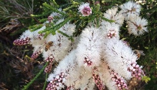
Eucalyptus gomphocephala, (aka Tuart). The Noongar peoples named the tree tuart or tooart, moorun or mouarn and Aboriginal people valued tuart woodlands as grounds for hunting and gathering and used bark from the trees to make weapons and tools.The dominant canopy on Clontarf Hill is the tuart. It is one of the six forest giants of Southwest Australia. Tuart forest was common on the Swan coastal plain.
Remnants of tuart forest occur in state reserves and parks. The DBCA estimates that before Europeans arrived there were more than 111,600 hectares of Tuart woodland.
The map shows the distribution of tuarts in WA. 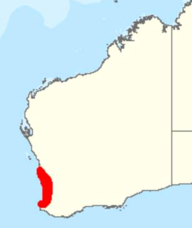
The eastern edges of the reserve is predominantly heath and low scrub dominated by Melaleuca huegelii. The Honeymyrtle shrubland on limestone ridges of the Swan Coastal Plain Bioregion ecological community is listed in the Critically Endangered category of the threatened ecological communities list under the Environment Protection and Biodiversity Conservation Act 1999.
Corridor
Aboriginal Heritage
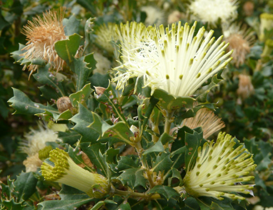
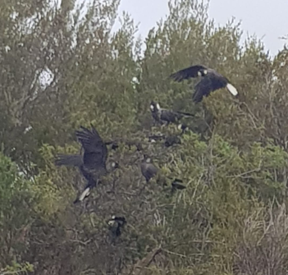
Clontarf Hill is now a registered Aboriginal Heritage site. The northern section is vested in the Noongar Boodjar Trust. This section of the hill is dominated by Boojak, budjan or butyak (Banksia sessilis), commonly known as parrot bush. It is a species of shrub or tree in the plant genus Banksia of the family Proteaceae. It flowers from late autumn to late Spring, and the seeds are eaten by the endangered Carnaby’s Black Cockatoo and ringneck parrots.
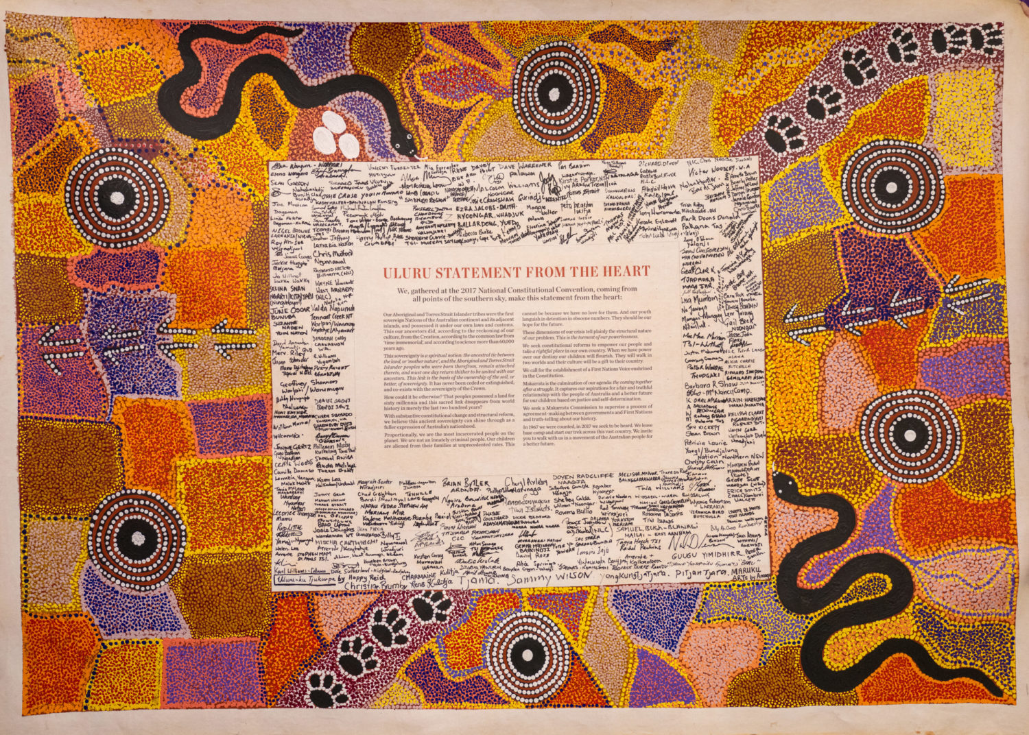
Whadjuk Nyoongar have lived for over 40,000 years in the vicinity of Derbal Nara or Cockburn Sound. Mythological stories relate Clontarf Hill as being part of a limestone ridge that was created by the Waugal, the sacred rainbow serpent. The hill holds the story of a mother and her two sons who are the protectors of Derbal Nara (Cockburn Sound), and who protect Derbal Nara from the Booyl-a-gatak, or sorcery coming from the north-west.
To find out more about the Aboriginal heritage of the Clontarf Hill area go to the Aboriginal Heritage Enquiry System or Derbal Nara.
If you wish to find out more about Aboriginal connection to the area go to the Early European and AboriginalHeritage Study – Hamilton Hill Swamp Precinct
Colonial History
1830
The earliest known British settler in the vicinity of Clontarf Hill was Sydney Smith, the agent of Captain George Robb. Smith built a homestead and established a farm at the foot of a small hill adjacent to and about 50 metres south of Clontarf Hill. In a letter dated August 27th, 1830, Smith gave his address as Hamilton Hill and this was the first recording of the name by which the suburb was to become known.
1840
Alfred Durlacher surveyed the Cockburn coast. His field book shows a sketch of the view looking west across Manning Ridge and Clontarf Hill. He described the general country around Clontarf Hill as, ‘country timbered with white gum, zamia, blackboys, wattle, with little good grass’.
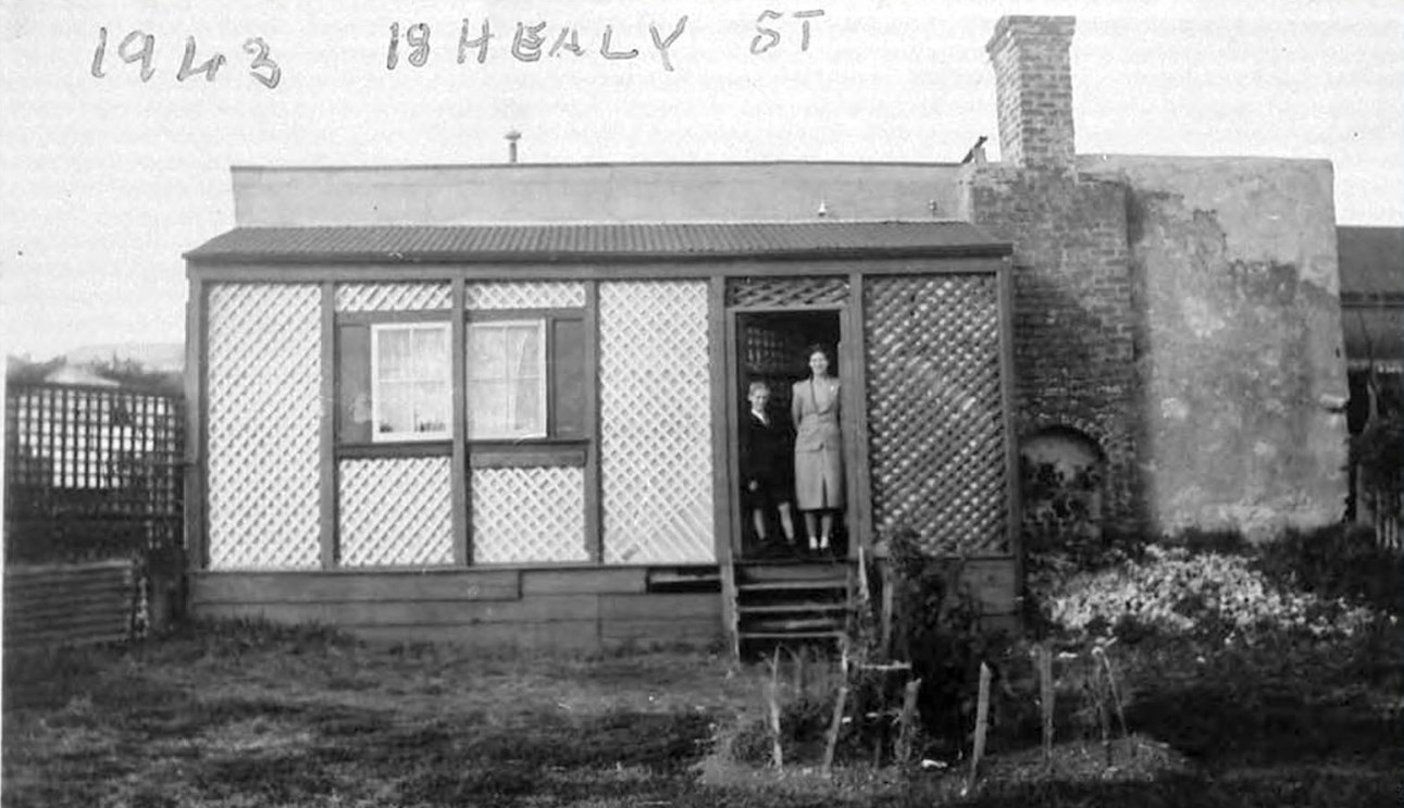
Clontarf is the anglicised version of the Irish form, Cluain Tarbh, directly translated as the ‘meadow of the bull’. The name is apt considering the early settler John Healy ran cattle on the property and much of his acreage was referred to as ‘bullock paddocks’.
1858
Irishman John Healy arrived in Western Australia and took up land grants in Spearwood, Hamilton Hill and Bibra Lake. His estate of 300 acres (121 hectares) north of Healy Road encompassed most of Beaconsfield. Healy operated a dairy that at one point supplied most of the milk supply of Fremantle. Healy’s cows grazed on Clontarf Hill. The Healy family home was a large house with a highly visible turret that is now incorporated into the Fremantle Portuguese Club.
1907
Several limestone quarries existed in the vicinity of Clontarf Hill, one of which was in Beaconsfield. The labourers in the quarry were predominantly of Irish extraction and they lived in shanty huts nearby including on Clontarf Hill.
The Fremantle Roads Board was encouraging settlement in the Winterfold Estate district facilitated by the partial construction of Healy Road. The Board received government grants for various projects in the Clontarf Hill area including cutting into Hamilton Hill. In a letter to The West Australian in 1911 a correspondent complained about the state of the road at Clontarf Hill, then known as Healy’s Hill. Clontarf Road was a bush track and there was no scheme water or electricity. At this time there were seven dairies in the area and six lime-kilns operating along Rockingham Road, providing employment to many labourers in the district.
1913
The Davenport family emigrated from England. The Davenports started a dairy in Clontarf Road on a property adjoining the Healy’s. At that time Hamilton Hill was known by some Fremantle locals as ‘the Never-Never’.
1913
Henry Septimus Dixon bought 24 acres at Ommanney Street near Clontarf Hill, five acres of which was around a swamp that is now buried under part of Dixon Park and the adjacent road reserve. Sep Dixon produced a thriving market garden on this swampy ground.
1920’s
Michael Healy and Septimus Dixon had sold their land around Clontarf Road and the area began to take on a more suburban nature as workers from Fremantle and local industrial works began to build their homes. However, the area around Clontarf Hill still retained many elements of its rural nature including bullock carts being driven along the roads and cattle being brought in for milking in the morning and evening.
1923
An outbreak of the cattle disease Rinderpest disease meant the dairy industry that had been established in the Fremantle and Cockburn areas was severely depleted by the extermination of dairy herds. Many small dairies never recovered from the outbreak and the introduction of trucks and refrigeration in the 1920’s meant that dairy farms could be further from their markets. In the early 1890’s a jetty was constructed near Catherine Point and a stockyard and slaughter house built for the landing and processing of cattle from the Kimberley. After 1923, the Clontarf Hill area of the Healy’s property was used for grazing cattle for the Kimberley beef industry.
Silly Town and Horse Racing
In the 1920’s and 1930’s the suburb of South Fremantle was known as South Beach and Hamilton Hill was known as Silly Town
In 1833 the first horse race in WA was held at South Beach. South Fremantle and Hamilton Hill became a hub for horse trainers and many racing stables were clustered in the neighbourhood around Clontarf Hill, particularly along Newmarket Street west of Clontarf Hill.
Betting was a local pastime in ‘Sillytown’ and illegal betting shops were common with many cases of illegal betting coming before the Fremantle Police Court.
The Newmarket Hotel became the social and community hub of the west Hamilton Hill district. On Friday nights the place was packed with local workers and goods and services were swapped and bartered and punters exchanged items like, meat, eggs, crayfish and vegetables.
World War II and Clontarf Hill
Remnants from the army occupation remain on Clontarf Hill allowing some interpretation. From 1939 to 1945, the Fremantle coast was defended by a number of gun emplacements housing anti-aircraft guns and searchlights. These searchlights were set up from 1939 along the coast from Bold Hill to Mt Brown and the Healy Road searchlight is likely to have been situated on the summit of Clontarf Hill. Today, the slit trenches, four feet deep left by the army searchlight stations remain. In 1944 a Special Operations camp was set up at Clontarf Hill. The Healy Road camp was set up to support the Garden Island facility with supply, maintenance, and administration. The main camp appears to have been in the flat area in the south-west part of the reserve, near the end of Gordon Road. It only lasted for two months until Sept 1944 when it was deemed to be inadequate for the needs of the Z unit and was closed.
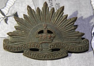
This badge was found on site and is one that was worn by soldiers in the Australian Army during World War II
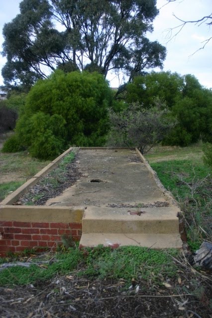
On the south-western side of Clontarf Hill are brick and concrete structures that belonged to the military during the war.
Playground
A flying fox running from the top of the hill down the steep slope to the ablution block on the southern side used by the army for defence personnel to get quickly down from the top of the hill to their camp remained after the war had ended. Many local children enjoyed playing on this until it broke. They also played in the slit trenches using the trenches as cover in battle games. During this time, on Guy Fawkes night, the local kids would make a huge bonfire on top of the hill. They also trapped rabbits using steel teeth traps and took them home to their parents to cook up in a stew. Another pastime was making traps for pigeons, that would later be kept as pets
1950s
At the base of the hill on the west side, a gardener known as ‘Marko’ cleared vegetation and established a market garden. Marko had a small shed and pump house and watered his garden from a well that is still in existence.
The Fremantle Eastern Bypass (FEB)
The FEB was part of the Western Suburbs Highway plan first included in the Perth Metropolitan Regions Scheme (MRS) as a Controlled Access Highway reservation in 1973. Clontarf Hill was set aside to link with Roe Highway Stage 8. Since its inclusion in the MRS the FEB has been the site of community campaigns won and lost and won again, with the fight to preserve Clontarf Hill at the forefront of the battle.
In 1997, 300 people walked the route of the FEB, culminating in a concert and blessing ceremony at Clontarf Hill. Father Donovan from Christ the King parish called for local people to stand up and fight for the hill and conducted a ‘Blessing of the Hill’, in the spirit of advocacy for the preservation of the hill as a place of natural heritage.
In November 2003, following a recommendation from the Western Australian Planning Commission, the land was removed from the Metropolitan Region Scheme by the Gallop Government.
We acknowledge and pay respect to the Whadjuk Noongar elders past, present and emerging whose land was never ceded.